Humphreys Peak, Flagstaff, AZ

Humphreys Peak, Flagstaff, AZ
Base meadow at Humphrey's Peak

Tuesday, July 24, 2012

Hike #44 - Angel's Palace Trail, Cannonville, UT


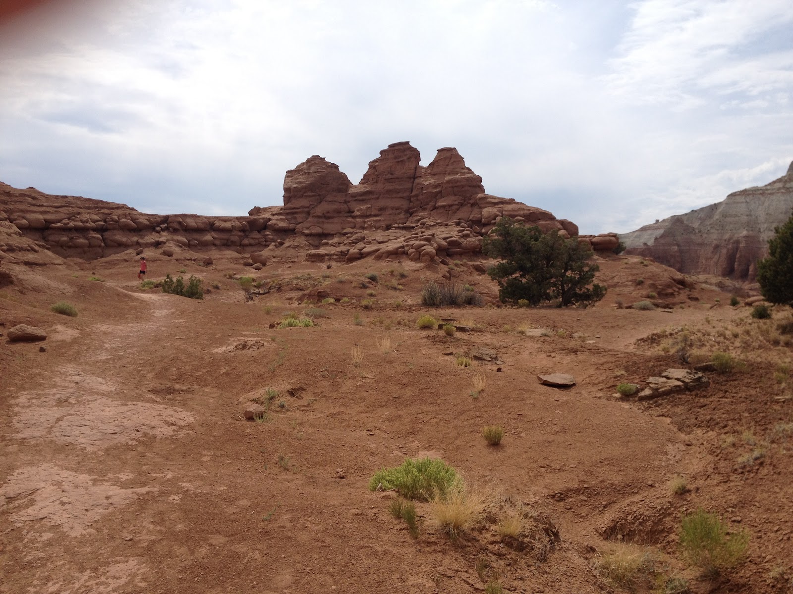
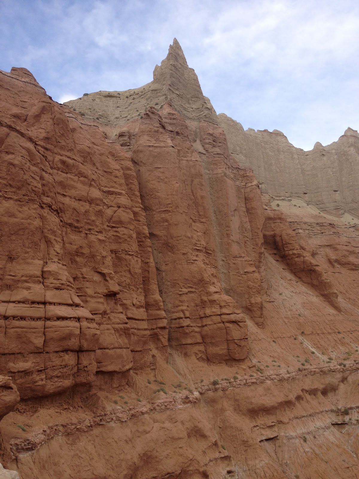
The Angel's Palace Trail was recommended to us by the ranger at the Kodachrome Basin State Park.  The trail is easy and only one mile round trip.  It has many interesting rock formations and some nice views of the park.  We came to Cannonville, UT to pick up our race packets for the Bryce Canyon Half Marathon which we ran on July 14th.


Monday, July 23, 2012

Hike #43 - Queen's Garden/Navajo Loop Trail, Bryce Canyon, UT


The Queen's Garden Trail is an easy trail that descends 320' into Bryce Canyon from Sunrise Point with magnificent close up views of the hoodoos.  This trail intersects with the Navajo Loop Trail which is a moderate hike through a "slot" canyon.  There are many switchbacks and unending photo opportunities.  We came out at Sunset Point where we had been earlier that morning.  Everyone we passed seemed to be from another country from the different languages we heard.  The distance of this combined hike was about 3 miles.


Sunday, July 22, 2012

Hike #42 - Sunrise/Sunset Point, Inspiration Point, Bryce Canyon, UT


 Bryce Canyon is best know for it's "Hoodoos".  Hoodoos are tall skinny spires of rock that protrude from the bottom of arid basins and "broken" lands. The Rim Trail at Bryce Canyon covers 11 miles and has beautiful views of the Hoodoo's.  It was a cloudy day so we missed the sunrise but it was a nice easy hike from Sunrise Point to Sunset Point, approx. .5 miles, then to Inspiration Point another .5 miles.  We saw rain in the distance and the rock formation named "Sinking Ship".  After breakfast, we came back to this area to hike the Queen's Garden Trail and Navajo Loop Trail.

Hike #41 - Mossy Cave Trail, Bryce Canyon, UT


Paul and I travelled to Bryce Canyon in July 2012 to run a 1/2 marathon and to do as many hikes as we could fit in.  The Mossy Cave Trail is .4 miles one way with 150' elevation gain. It is an easy hike that follows a stream which Mormon pioneers dug as an irrigation ditch in the early 1800's.  There is a nice waterfall at the end of the hike."The grotto or cave is a shallow alcove filled with moss. Dripping water feeds the moss and provides a  delightful retreat from the summer sun." http://www.zionnational-park.com/bryce-canyon-mossy.htm


Hike #40 - Constitution Trail, Bloomington, IL


My home town is Bloomington, IL so during my visit with family over the 4th of July I hiked The Constitution Trail.  My cousin Patty Wilson joined me, taking me to the prettiest part of the trail, also the most shady since it was a hot muggy day on July 4th, 2012.  The trail covers 24 miles through the cities of both Bloomington and Normal, Illinois.  The path is in the place where the Illinois Central Gulf Railroad had been but was abandoned.  There are signs along the way that cover key portions of the Constitution and how they aply to our daily lives.  These include: The Preamble, The Bill of Rights, Article One, Article Two, Article Three, Article Five.

Sunday, July 1, 2012

Hike #39 - Harding Springs Trail - Sedona, AZ


 Harding Springs Trail is in beautiful Oak Creek Canyon.  Like many of the trails in Sedona, it was built by cattle ranchers to bring their cattle to and from the plateaus above.  Paul and I had already hiked a similar trail that morning just a couple miles north on 89A, The Cookstove Trail.  It was late morning on June 24th, and as usual we did not pass any other hikers.  This trail has a 1200' ascent in approx. 1 mile. This trail can be linked to the Cookstove trail to make a 5 mile loop.  It took us 28 min. to hike up and approx. 18 min. to hike down.  We stopped at the top to relax on some rocks and take in the unusual rock formations on the West wall of Oak Creek Canyon.  Trailhead elevation is 5,500' and Top Elevation is 6,250'.


Hike #38 - Cookstove Trail, Sedona, AZ

The Cookstove Trail in Sedona, AZ was originally built to provide access to forest firefighters into Oak Creek Canyon's wooded slopes.  The trail is one mile long with an elevation gain of approx. 900'.  The trail is steep with lots of switchbacks and climbs through mixed conifer trees, Gambel Oaks and juniper trees. We had beautiful views of the Cocomino Sandstone cliffs that make Sedona so magnificent. We stopped to get a drink from the natural spring across the road from the start of the trail.  June 24, 2012