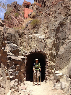
"The South Kaibab Trail was constructed by the National Park Service in the early 1900's to compete with the privately owned Bright Angel Trail and offer tourists a free access trail to the inner canyon and the Colorado River." http://www.bobspixels.com/kaibab.org/bc/gc_tr_sk.htm
The trail is steep and slippery in places. We carried plenty of water and snacks. There are restrooms at 2 stops along the way. After an hour or so we were shedding our long sleeve shirts since it gets warmer as you descend. It was a clear day with lots of sun but we were in the shade for at least half of the trip. The distance of the trail is approx. 7 miles to Phantom Ranch. We started at an elevation of 7260'. We stopped at the first rest area, Ooh-Aah Point, approx. .9 miles and elevation 6660. The next rest area is Cedar Ridge, 1.5 miles and the last rest area is Skeleton Point, 3 miles. The Colorado River is at elevation 2420' - 4780' below the rim. My knees started bothering me about 1/2 way down. I slowed down, took Ibuprofen and stopped more frequently and we still made it to Phantom Ranch by 12:30 PM.


No comments:
Post a Comment